Saturday 4/16 Wednesday 4/20
Well, it ended up being four zero days.
On Saturday I got a room at the Microtel behind the Shoney’s. I arrived at 2 pm and they wouldn’t allow me to check in until 3 pm. Not a problem, they allowed me to put my bag there at the lobby and I went to the Shoney’s to pig out on the buffet.
After checking in I took a shower and changed my clothes. Then I took off trekking to WalMart for some needed supplies. The WalMart in Franklin was on the outskirts of town about 2 miles away along a road that didn’t have much of a shoulder. I was game.
By the time I got to the intersection where the Walmart was I was feeling hunger again and since there was a Chick-fil-A there I grabbed my dinner.
After dinner I went into WalMart; the main item was to get a pup tent and an SD card reader with a lighting connector cable for Waldo IV. I found no pup tents, the smallest they had was a three person tent but over in the sporting goods section I found an SD card reader that was designed for the trail cameras. It works with my iPhone, that’s all that matters. I picked up some fresh fruit for the next couple of days also.
Once I left WalMart it was dark so I gave Uber a try. No go. Then I called the local Taxi company. They were closed for Easter Weekend. I don’t blame them one bit. The Hotel had a list of trail angels willing to shuttle hikers around town. Too bad I didn’t think to copy that list. Oh well, only one thing to do; start riding the soles of my shoes back to the hotel. In the dark.
Sure am glad I was wearing that neon green hoodie.
I strolled back to the hotel along that same road, except I was now playing a game of dodge cars. It took a few more moments to get back but I did without having to chunk rocks at anyone.
At the hotel I downloaded the Farout App and paid for the Appalachian Trail maps. It looked very detailed. I think it’ll work out.
Sunday was Easter Sunday but since I hadn’t done laundry yet and didn’t feel like showing up for Mass in just a T-Shirt, Shorts, and Sandals I just rested at the hotel.
Monday I was up bright and early with my pack packed with dirty clothes and headed off to St. Francis in Franklin. It was 9/10th of a mile away. I got there right at 9 o’clock like the website said that weekday Mass was but the doors were locked. An outside bulletin board announced that there were no masses scheduled until the coming Friday.
Then it started to rain. So I sat under an awning next to the church and had an impromptu Holy Hour.
It was better than the apostles; they slept through theirs.
After the rain I went to the laundromat, only to realize I hadn’t carried any cash money.
D’oh!
So, I headed back to the hotel to get money and stopped at Sonic’s for lunch. Then a short nap at the hotel and finally back to the laundromat for laundry; with cash money.
After laundry I stopped at the Three Eagles Outfitters and picked up an item or two with postcards. They didn’t have stamps for the postcards but a lady there offered me enough letter stamps to mail the postcards. Free of charge; more trail magic.
Later that night I noticed that the next two mornings were going to be near freezing. I mistakenly extended my stay till Thursday; or maybe it was a freudian slip.
Tuesday it was raining so I basically chilled at the hotel.
Wednesday I got out and walked into town and strolled around a bit. When I returned I readied my pack for leaving on the morrow.
Thursday 4/21 Siler Bald Shelter
I caught a Shuttle for Winding Stairs Gap at around 10:30. This was a municipal shuttle that only cost $5 and went to both Winding Stairs and Rock Gap.

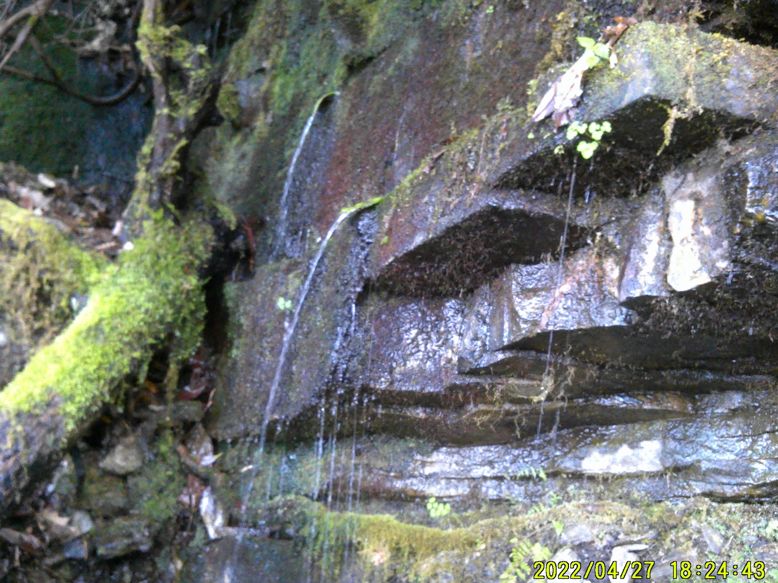
At the gap, I started up the trail. It was a series of switchbacks with a wooden bridge that crossed a creek. Soon I passed through Swinging Dick Gap.
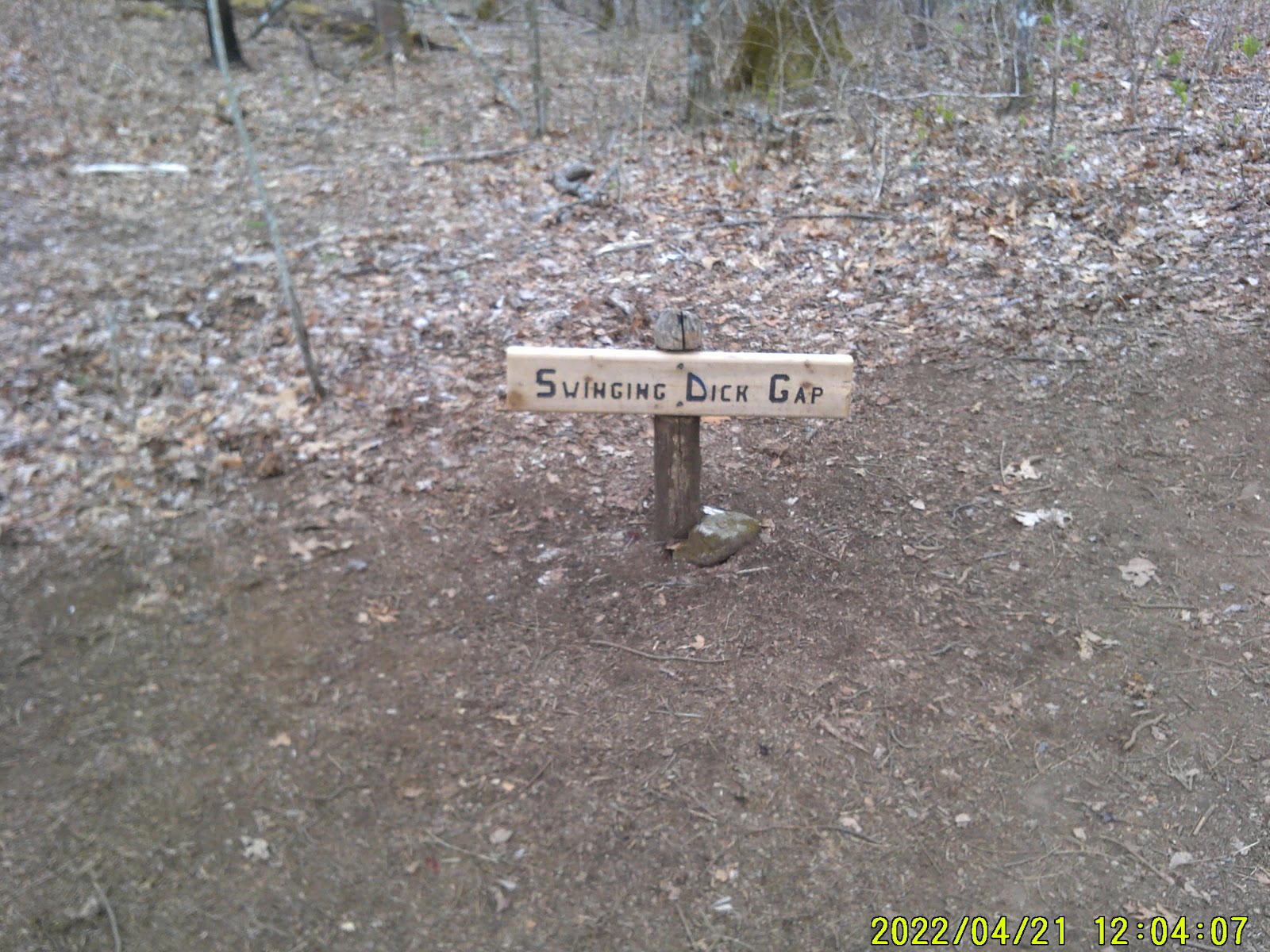
It had a sign there saying that but I think someone was having an elaborate joke. The app lists this gap as Swinging Lick Gap.
I took a small break at Panther Gap and then pushed on to Siler Gap. I found the cut off trail and the shelter was about ½ mile down this trail. This was actually the Siler Bald trail.
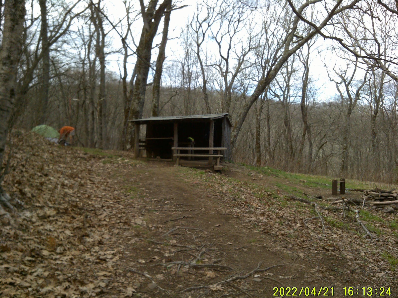
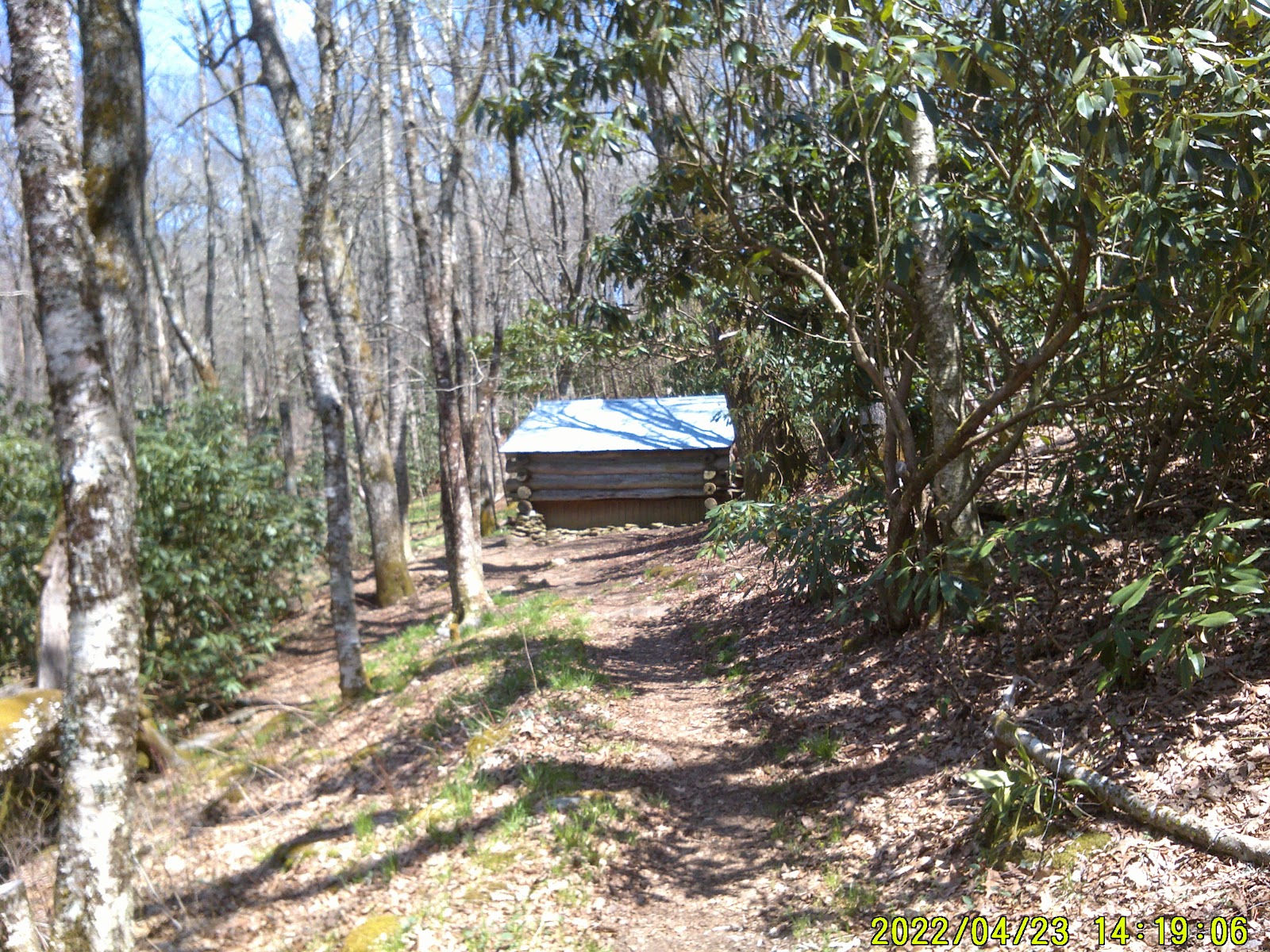
The shelter was nice with a stream nearby and a large lawn to one side.
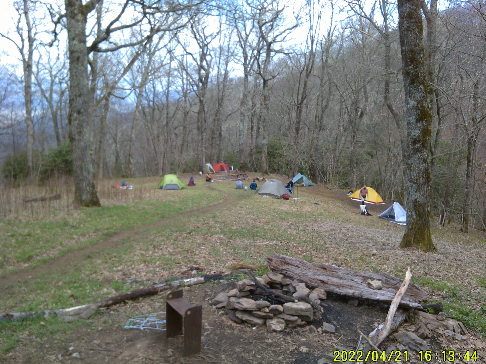
The campers with tents were all on the lawn. About this time ol’ Frypan showed up. He was called Frypan because he had a stainless steel one he carried and cooked in. He’s decided to hike the AT on the fly. His gear is pieced together. He carries a book bag on his chest that has his food. And a four person tent in his pack. He had a pack of that dehydration food and he put way too much water in the pan with it. It looked more like soup.
After bedding down another hiker came in right after dark and claimed the far wall of the shelter. It was an uneventful night; until the morning.
AT 113 - 2080 to go
FRIDAY 4/22 Wayah Bald Shelter
Before dawn a majority of the Hikers cleared out. I believe they were headed to Siler Bald to watch the sunrise. They sounded like the thundering herd when they went by the shelter, with red headlamps.
Frypan was up at sunrise and gone. I was about 15 minutes behind him.
I followed the trail which at this point was an old dirt road and at an intersection I noticed that the blue blazes led up a hill to the left. The map showed that the road continued downhill and connected with the AT. Phooey on that hill, I continued down the road.
The road connected with the AT just south of Wayah Gap. That’s where Frypan caught up with me. He was awfully surprised. Seems I may have cut a mile or two off my travels.
After Wayah Gap it was a steady uphill climb. It was along here I first met Charlie and Company. That isn’t their “official” trail name but it was a father, who was 62, hiking with his 40 y/o daughter, who was taking their dog Charlie along. Charlie was a black and white medium build dog that looked like he had some border collie in him. We played tag along the trail. They would get ahead of me then dad would have to rest and nearly fall out, aspirating while smoking a cigarette. And I would pass them.
Late afternoon I finally gained the Wayah Bald fire tower. I had no sooner got there then up come Frypan. There was a wedding going on around the parking area for the fire tower and Frypan secured us a couple of Coors lites beers.
Bless him.

We used the tower as a photo opportunity and I allowed Frypan to use my phone to call his brother. Frypan was hiking without a phone. After a while we continued on down the trail which continued behind the tower until we got to the shelter.
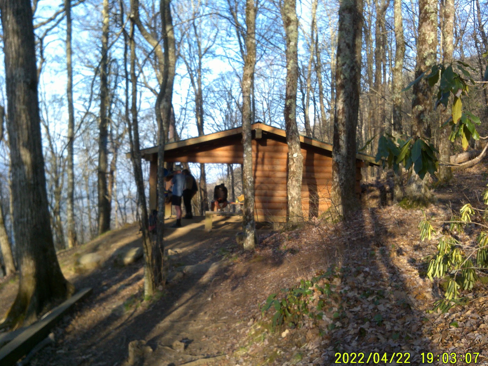
We both claimed a spot next to the wall opposite of each other. My dinner consisted of ramen noodles with tuna and Frypan made his infamous “soup”. Ol’ Jayhawk showed up as well.
AT 120.4 - 2073 to go
SATURDAY 4/23 Tellico Gap
When I awoke Frypan was already packed. He watched the sunrise over the mountain saying that was one of the things he had never seen before. We said our goodbyes and he hit the trail. He was trying to make it to NOC and Bryson City because his brother was picking him up to go back to Birmingham for some legal matter. I’m sure I’ll see him somewhere along the trail again. Hopefully with a better pack.
I myself was on the trail by 9 am.
By Dickdog Gap, (lickdog on the App) I had stripped off all my outer layers of clothing.
Then when I got to Burningtown Gap there was a van there with trail magic. It was actually there for hikers, who were hiking for Cystic Fibrosis, from Rock Gap to NOC; a total of 30.8 miles in a single day. These folks were slack packing and these stations were set up for them so they could refuel, but they weren’t turning away thru hikers. I was offered refreshments and I got a flat bread and a single serving tub of guacamole; sooo good! Charlie and Company arrived while I was there.
After a few minutes of resting I continued on up the trail which was a steady climb. I got tired and dropped my pack, then took a quick nap beside the trail. As I awoke Charlie and Company was passing me. I got up and continued on.
In only about a tenth of a mile I saw the back of Cold Spring Shelter. This is a shelter that was done right. The trail went right up to the shelter and had to veer around it. The opening of the shelter faced north and within a hundred feet was a piped spring for the shelter. They all should be like that. I dropped the pack again and refilled my water bottle. Charlie and Company was already enjoying their own Siesa. I was wanting to push on and make some more time so I was only there for a few moments.
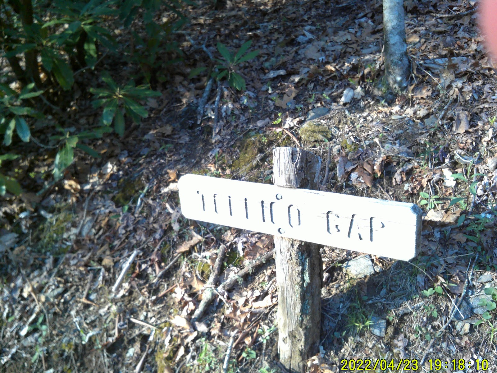
At Tellico Gap there was a box of trail magic there. The angels may have set up there earlier then left the box. In it were those Smuckers PB&J little samwiches, granola bars and a bag of Cool Ranch Doritos. I grabbed the Doritos and a PB&J. On the other side of the road I set up a cowboy camp underneath some Rhododendron bushes. By now it was getting dark and I went to sleep.
AT 128.8 - 2064 to go
SUNDAY 4/24 Wesser Shelter
I woke up and readied my pack. I forgo breakfast and grab another PB&J for the box instead.
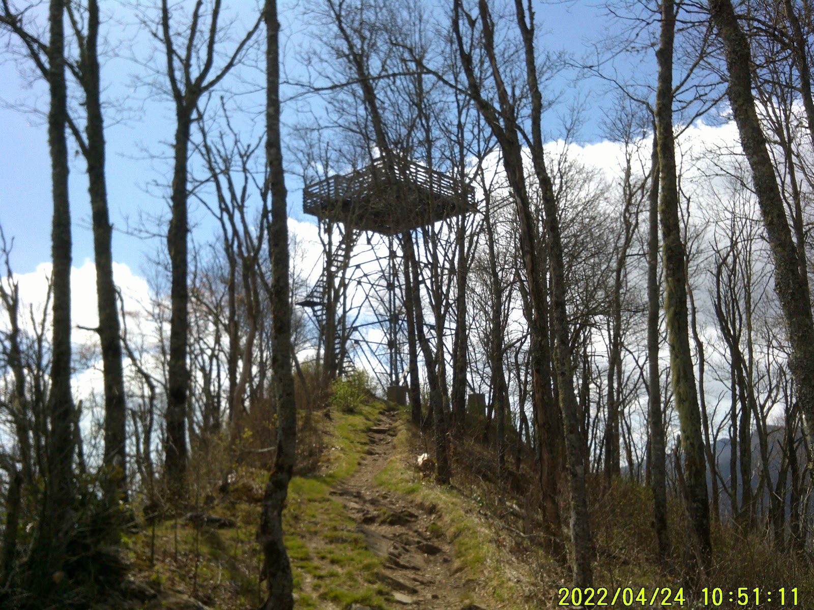
It was another steady climb up to Wesser Bald. Charlie and Company were already at the top. Dad was partaking of a breathing treatment. The firetower was an old iron framework tower. I’m sure at one time there was an enclosure at the top but now it was just the deck. I climbed up to the first landing but my acrophobia said, “Hold on Boss! This tower don’t look safe. You try and go up any further and I’ll have you cleaning your shorts out! I mean it, ya’here?!?”
The problem was that the first landing didn’t really get me above the treetops to take better pictures. Soon I climbed down after some fierce negotiations with my acrophobia; which I lost. It is the most stubborn thing; worse than a mule.
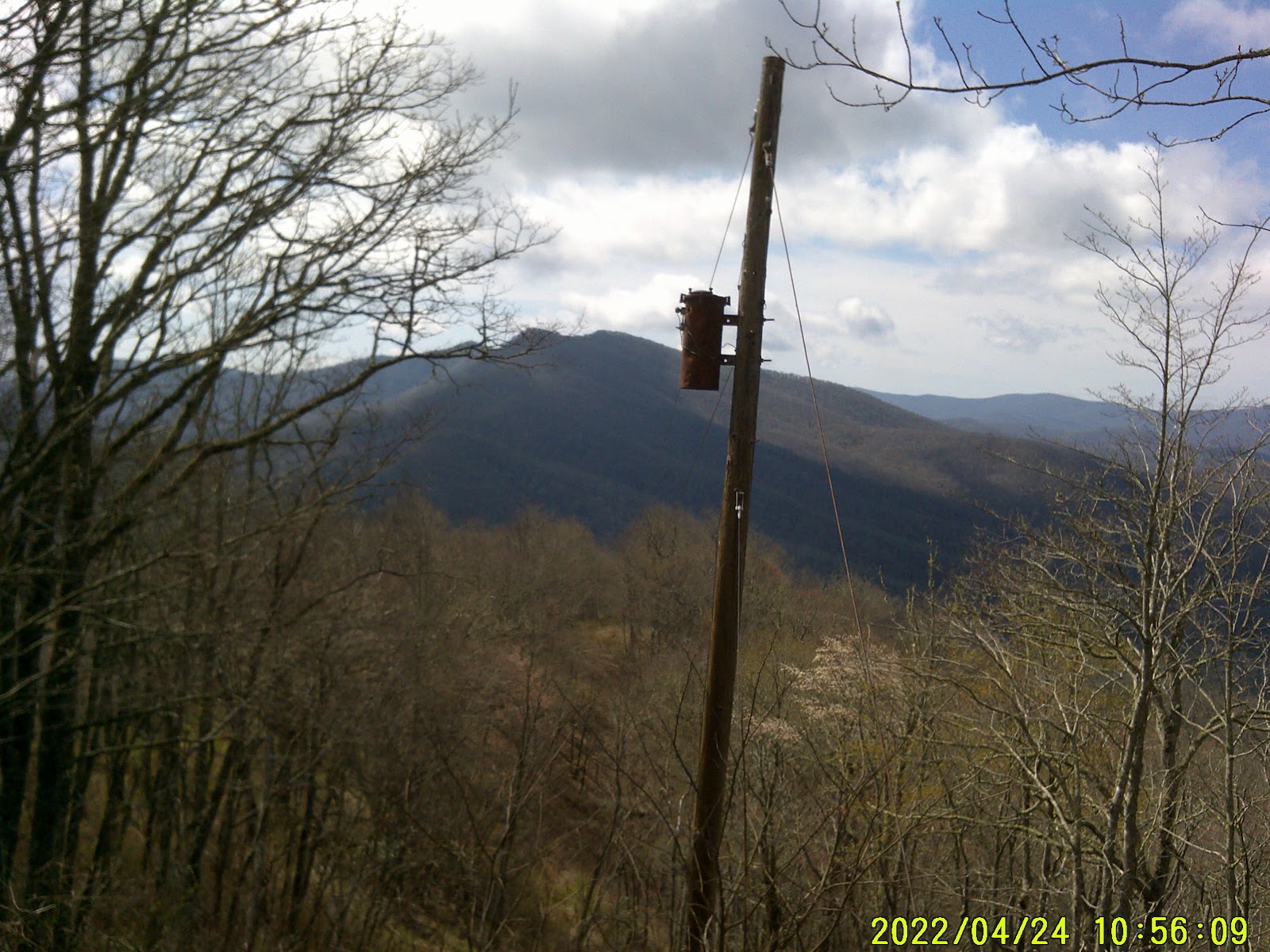
I climbed down and looked over the old access road that came up to the tower. I found an old utility pole that still had the transformer on it but no wires leading to or from it.
Soon I was heading northbound again.
Just a little ways from the tower was a water source. It was an old concrete cistern that was designed to be connected to the rock and the water flowed into it. The foundation had shifted and the cistern had tilted away from the rock. A piece of PVC pipe had been rigged to feed the cistern and allowed the hikers to fill their bottles straight from the pipe before the water went into the cistern. Nifty.
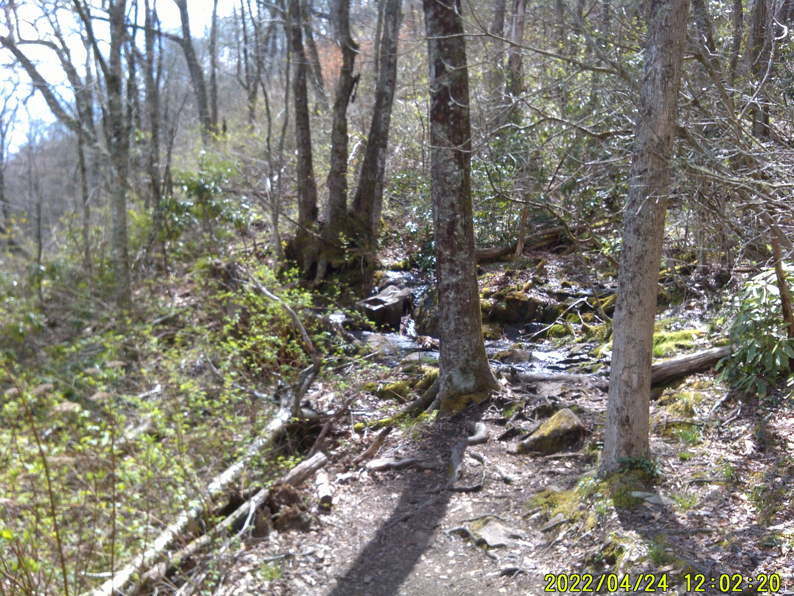
The shelter was ¼ mile away. I filled up my bottles and made my way to the shelter. There I went about fixing my breakfast. I wasn’t feeling very well. I attributed it to being hungry. Back at the Wayah Shelter someone had left a pack of freeze dried breakfast skillet. I had snagged it. It was what I was fixing to eat. I had to wait about 15 minutes for the boiled water to work its magic on the contents but it was pretty good. I did wonder what the cost of that pouch was because they can get pretty expensive.
I still didn’t feel better so I took a nap. When I awoke there were others there. One of the others there had a pair of limb loppers and I knew he had to be a trail ambassador. Well, the loppers and the slack pack he had. He picked up right away that I wasn’t feeling well and he offered to help me get to NOC.
He would have walked with me and carried some of my pack to ease my load.
I told him I was good for the moment. He had given another hiker his number and if I wasn’t feeling better in the morning I was to give him a call and he would come back and help me out. I told him that if I wasn’t better by morning or if I started to get worse then I’ll have him called. It’s great to know there are those who are willing to help you.
In a little bit ol’ Jayhawk showed up. He set up his bedroll in the Shelter with myself and another young female.
About 5 pm I started to feel better and I returned to the cistern to get more water. Now there was a line of other hikers getting water. It took a few minutes but with my water secured I returned to the shelter.
I spent the evening talking to the other hikers who came into the shelter to prepare their meals. I ate my own dinner and then at dark I got into my bedroll and went to sleep.
I was awakened by the female hiker fussing at Jayhawk about something. I wasn’t sure what the fuss was about so I just kept out of it and was able to go back to sleep.
AT 131 - 2062 to go
MONDAY 4/25 Rufus Morgan Shelter
I woke up early but allowed the others to do their thing and hit the trail. All were out and gone by 8:30 am. Jayhawk was the last to leave. He told me that what the other hiker was fussing about was the fact that he had left a water bottle on the table that had Kool-aid in it. As if that was going to bring a thundering herd of bears down upon us. That woman slept with one of her trekking poles next to her, not because she was afraid of a man trying to accost her but if a bear came into the shelter and attacked.
As I’ve said before; if one is afraid of bears that much then you don’t need to be outhere.
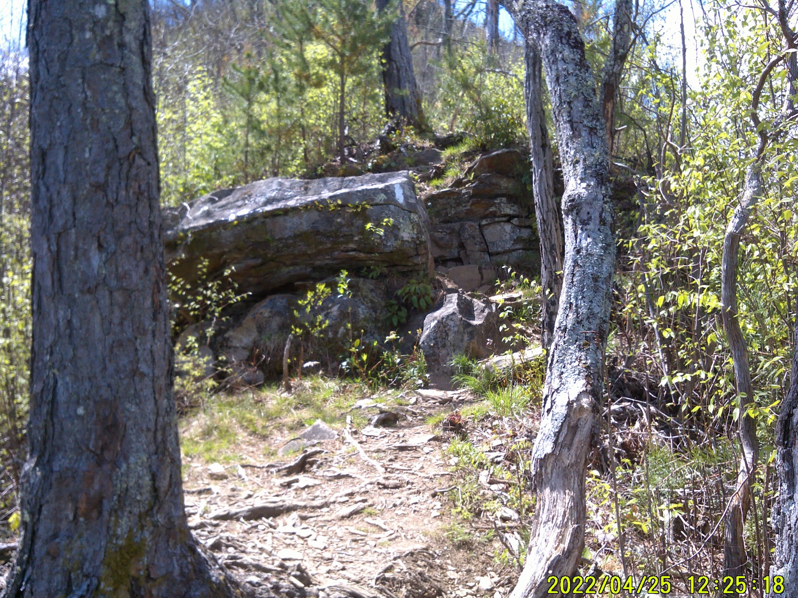
I dilly dallyed around until about 10 am before I started. The first climb was a gradual climb with a beautiful view at the top but with a limited vista thru the trees. I descended into another gap then climbed what is referred to as Jump Down.
Jump Down is a ridge with a spectacular view on either side that’s about 500 ft in length. Then it starts down on a very steep and narrow trail. At one point you get to the point that gained the name Jump Down. It’s a jump from a rock downward that’s about 3 ½ ft. What in the ‘ell were they thinking about routing the trail this way. I’d broken a leg or two and would have been carried off that mountain if I’d had made that jump with my pack.

Being carried off was an even scarier prospect.
I dropped my pack and climbed down very carefully using all four limbs. I then grabbed my pack, donned it and off I went. The rest of the descent was beautiful.
Soon I was seeing dogwood in bloom in the distance.
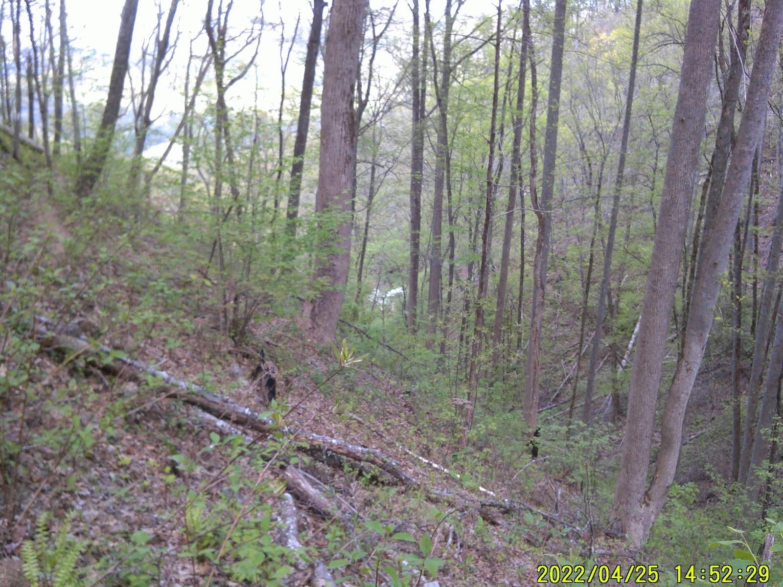
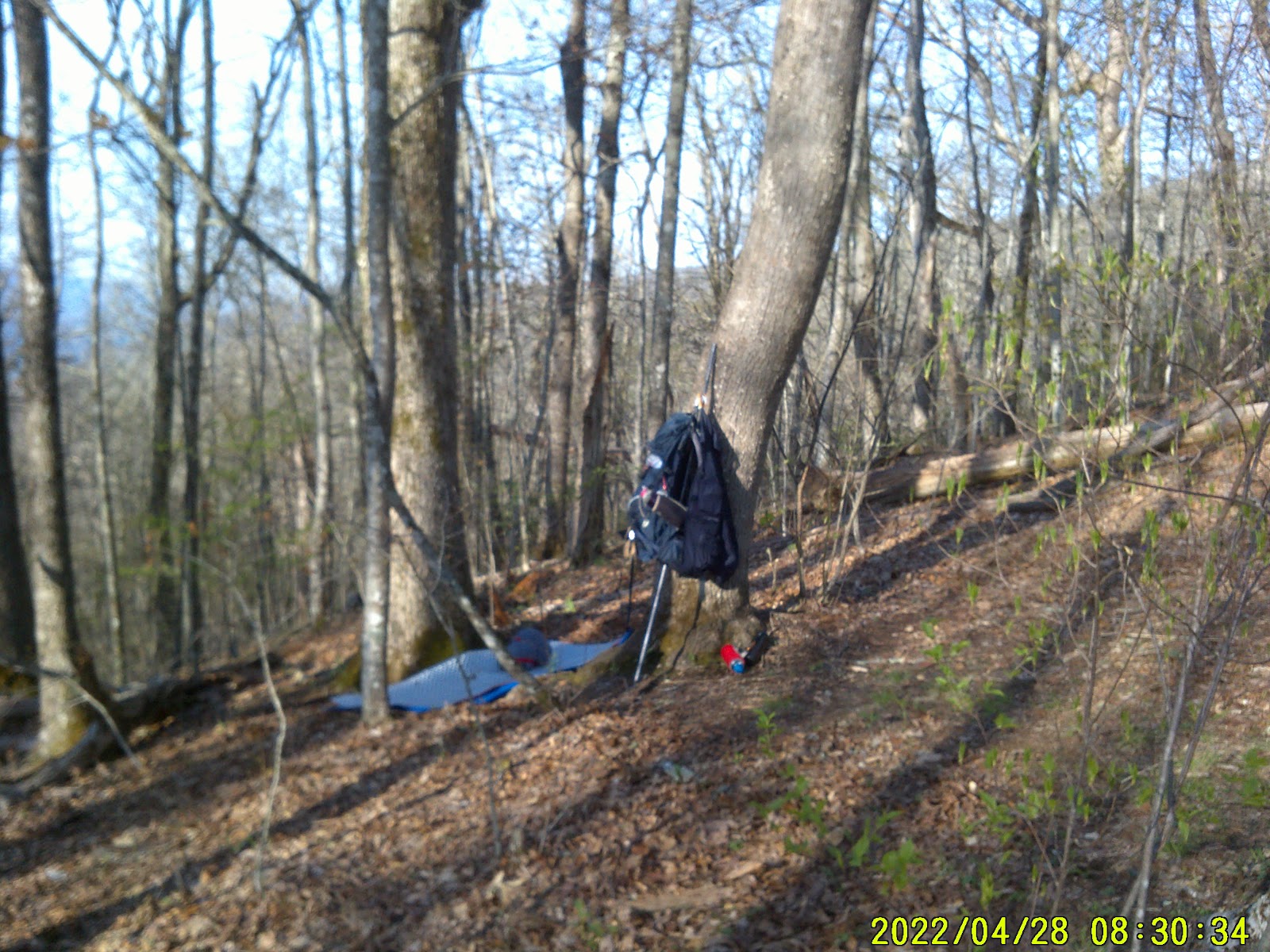
And a little later I came into the gap that housed the Shelter. I was tired by now and decided to stay the night. I knew that the bubble that had left that morning before me was all heading to NOC about ¾ mile away and I really didn’t feel like competing with them. I’ll make it in the morning.

The shelter itself is about 500 ft up from the gap and I dropped my pack there. There is a small stream that runs beside the shelter but it’s not really suitable to get water. There was a nice creek on the other side of the gap.
A trio of hikers showed up and set up hammocks just a little ways up from the gap. They had a rain fly that formed an actual enclosure around the hammock. I’ll have to look into those. Soon another hiker showed up at the shelter itself. He was going to sleep under the roof. He had a bivy bag with a mosquito net over the face opening. The air mattress was placed inside of the bag. It looked pretty nifty.
Tried as I might, I just couldn’t find any cooperative limbs to hang my food bag so I just placed it on the roof of the shelter. The other hiker didn’t have any luck with his’ either and just hid it out in the woods.
As I was going to sleep that night I saw the fireflies so I knew we were going to be guarded by the fairies.
AT 135.9 - 2057 to go
TUESDAY 4/26 Gatewood Cottage @ NOC
I woke up early and got ready to go.
I talked to the other hiker a bit. He was from Arizona. He was scared of poison ivy and asked me if I could show him some. I did a quick look around and there were none to be seen. I told him to be careful of the vines he sees crawling up trees or hanging loose because those were poison ivy and some of the young plants that can affect him would surely be around.
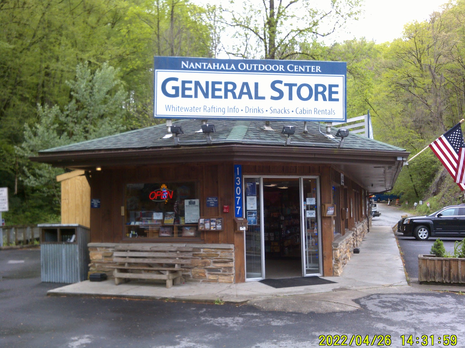
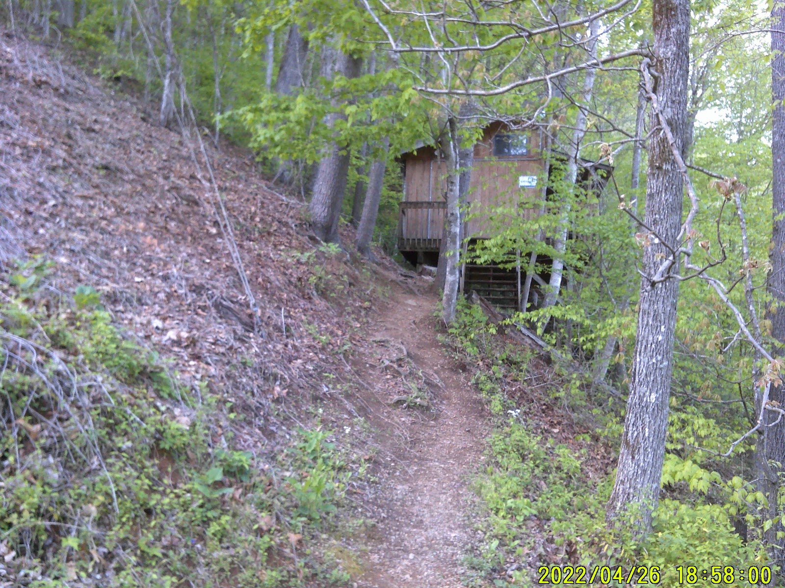
I headed to NOC. About ¼ mile down the trail it started to rain. And it rained until after I got to NOC. I first stopped at the general store and noticed that it's not much of a resupply point. I’m sure that catching a shuttle into Bryson City would yield greater results. I talked to the person behind the counter about laundry and getting a shower. The laundromat was located on the far side of the building that the General Store is at and the Showers were up in the Basecamp compound. A shower came with a hostel rental but would cost about 4 dollars by itself. I would also have to “rent” a towel if needed, about another 4 dollars. The washer and dryer were two dollars apiece and tide pods went for 50 cents apiece. He started getting out the quarters I would need and I told him I would have to get the shower first and change into my clean clothes then bring these nasty clothes I have on down to be washed; after it stopped raining. He agreed that that sounded like a good plan.
I bought a Mr. Pibb and a snack size tube of Pringles then enjoyed a snack while waiting on the rain to let up. I checked out my pack and realized it had gotten wetter than anticipated. A lot of the items would need to be dried out. That’ll teach me not to use the pack’s rain cover.
I enquired about the hostel and the rates were cheap enough, (operative word: cheap) so I decided to get a room for the night. Got the room and I had to pay extra for my towel. I was put in the Gatewood Cabin. I was given a carticure map to my destination.
I got lost.
You see what had happened was:
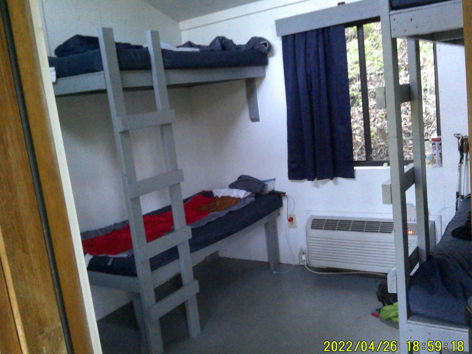
First you have to cross the river then go through the compound. Then you cross the railroad track. Then a small wooden bridge. This is still the AT. Up a hill with some steps that were designed by the step maker that is clueless about his craft then take a side trail to the right that goes to asphalt on an over 15 deg incline and head up. Looking at the map I took the wrong turn and continued up that asphalt lane that goes by the bike shop. At a private entrance gate I realized where I was from the map. I had taken the wrong lane. But this lane did curve around to the cabin. Soon I was walking down hill and to the trail to the cabin. That trail would have been a favorite to a mountain goat. The room was basically a pair of bunk beds, four in all, that were about the size of a semi sleeper cabin mattress. Enough for yourself and room to sleep with your stuff if you wish. There was also a small long table. The mattresses were vinyl covered and there was no linen. One was expected to use one’s sleeping bag.
There was 139 steps from the Gatewood to the Basecamp and showers.
After my shower and change of clothes I took my laundry and towel to be washed and dried and stuffed them into my sleeping bag. I planned on another shower before I left.
The restaurant was open by the time I got back to the highway so I left my bag on the bench outside of the restaurant and went inside to eat.
I got a hamburger with swiss cheese and an unsweetened iced tea. It was good but I had sticker shock when I got the tab. I should have known but I paid no attention to the prices when I ordered. It was a pricey mistake.
(no he’s not gonna divulge the cost)
I then took my laundry across the street to the General Store and even with it busy the Clerks remembered and started to dig out quarters for me. I got two tide pods. This load is awfully dirty.
I waited for the clothes to go through the wash and transferred them to the dryer then I mosey on over to the Outfitters to check them out. This since NOC is mostly about kayaking that is what the majority of the equipment was about. There was some supplies for the thru-hikers and I got a couple of straps for the food bag. I also got some postcards.
Once my laundry was done I lugged the bundle back up to Gatewood. By then I had gained two more roommates for the night. One man was from Michigan and the other was British from Essex. I could tell a marked difference between his accent and another Brit I knew who was from Liverpool. I mentioned that and the Essex man said that even he had trouble understanding those from Liverpool.
I sorted out my laundry and realized I didn’t launder my socks.
D’ho!
I left and went to the compound to take some pictures of NOC. I stopped back by the outfitters to get the Great Smoky Mountain National Park permit I would need so I wouldn’t have to sneak around in the park like a Mexico National north of the Rio Grande but they had already closed for the evening.
I stopped by the General Store and bought an Italian sub and a couple of packs of Wet Wipes.
At Basecamp I washed my socks in the sink with hand soap and then held them over the hand dryer and dried them. Worx!
I returned to my room and the third roommate had shown up.
I filled out the postcards and was in bed by hiker’s midnight.
(that’s as soon as it gets dark)
AT 136.9 - 2056 to go
WEDNESDAY 4/27 North of The Jumpup
The first two hikers from last night were up and out the door at dawn.
I waited until sunrise then mosey on down to Basecamp and raided the Hiker’s box. I got a couple of bagels and found a little cream cheese.
I showered again and left the towel.
Back up to the Gatewood and the third hiker was gone.
I gathered up my gear and transferred it to the community room at Basecamp.
I then went to the Outfitters to get my permit.
They had a URL address to get the permits but it wasn’t wanting to work on my iPhone. The clerk was very helpful and applied for my permit on her computer.
I got the email then forwarded it to NOC’s email. They printed the permit out for me and I was ready to go.
At Basecamp I waited a few while my phone charged then I hoisted my pack and I was off.
Again a steady climb from NOC.
Then I reached Wright Gap. I was tired and put my pack down then took a nap; for an hour; now it was getting late.
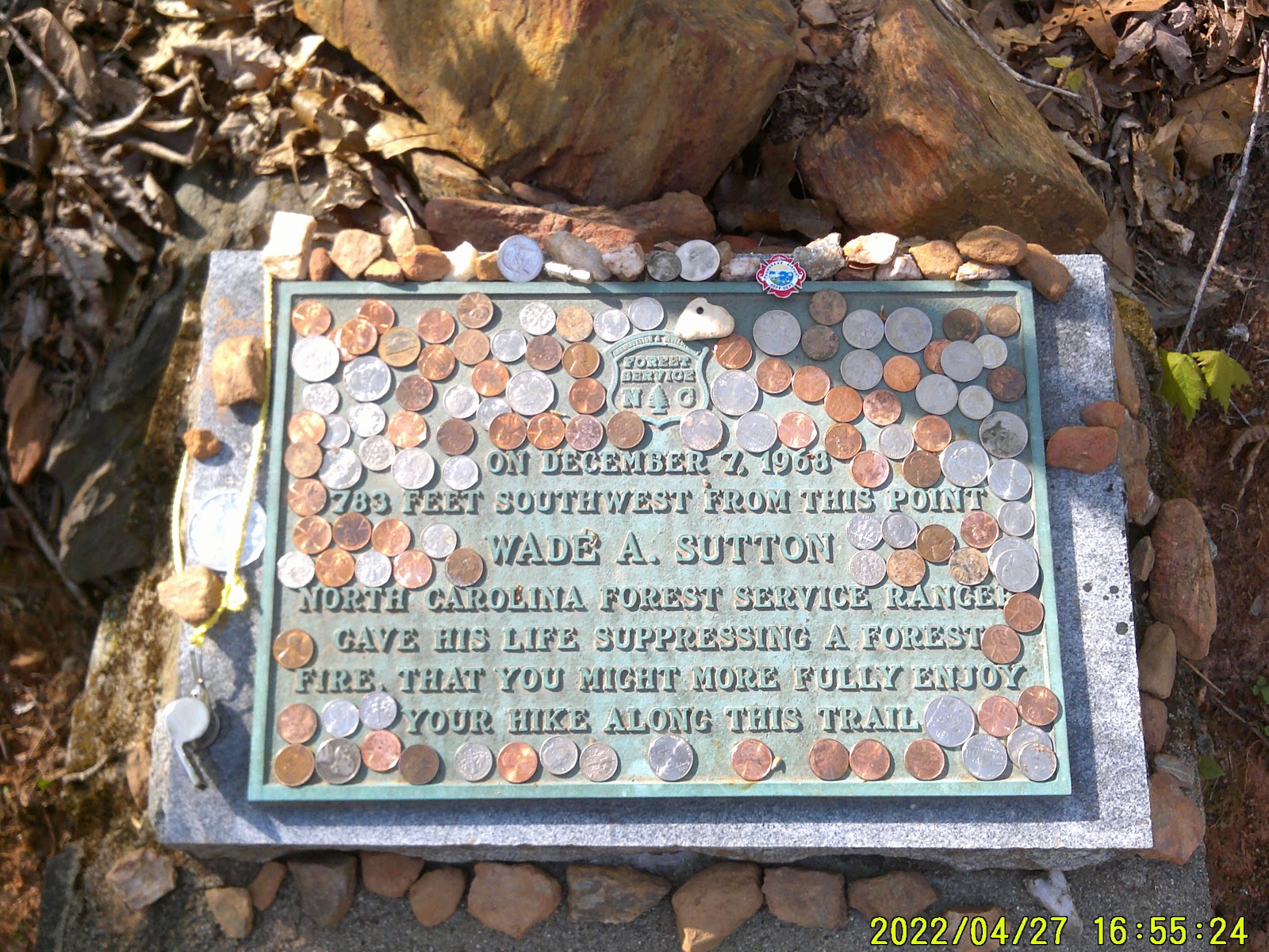
Again with the steady climbing and after I had reasted a moment or two at a small campsite beside a stream I reached the Wade Sutton Memorial.
I snapped a photo or two and then I was off again. Up pass Grassy Gap (no grass, just sign) then a steady climb to the next stream. I got my fill of water for the evening but it was getting late and this area didn’t offer too many opportunities to camp. I then had to maneuver through a stone garden then I made Jump Up. Another narrow ledge that was still going up the mountain with an excellent view.
There were very few blazes here and I was worried that I wasn’t on the right train. I would soon lose the sun and this was not an area I wanted to navigate in the dark. I trudged on.
Soon the ridge widened and there were a few camping opportunities. Another hiker had already set up his camp. We chatted for a few and I told him I was going to set down here. He started acting like I was invading his private space or something. I made my dinner and watched the smoke from his fire. It gave me a good indication of how the wind was blowing. I was able to choose a spot on the other side of the trail in a little hollow between two trees that would be under the wind. Quickly I got my bed roll laid out. Then I hid my food bag. By now it was dark.
I crawled into my bedroll and slept
AT 141.8 - 2051 to go
THURSDAY 4/28 Locust Cove Gap
When I got up in the morning the other hiker was gone.
I broke camp and forgo breakfast again.
The first order of the day was to climb.
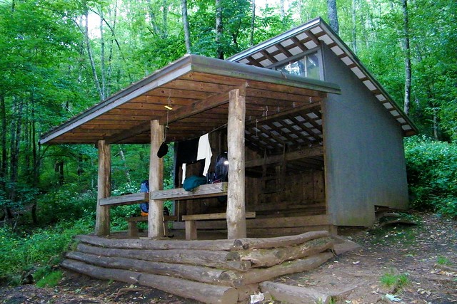
I climbed three different hills with an elevation of 4532, 4638, and 4689 in less than a mile then it was a descent down to Sassafras Gap shelter, which I made by noon. The shelter was at an elevation of 4328. I cooked a meal and took a long siesta. I still had Cheoah Bald to climb.
Three male hikers came up to the shelter wearing what looked like boxer briefs. One was pink with a blue something pattern, one was the American flag, and the third is the Texas Flag wearing cowboy boots and a caricature cowboy hat. There were several female hikers at the shelter at that time. As if they were of one body, they all decided it was time to go. I didn’t want to be rude so I waited about fifteen minutes.
Those guys were nice, they inquired about my command ball cap and I told them that I had served on the USS Enterprise from 80 to 84. Turns out the hiker with the pink briefs was ex marine and the cowboy boot wearer was ex Air Force. The third had gone to the privy and no one mentioned his possible prior service.
I wished them well on their hike and started to move on. Cheoah Bald is 1.2 miles away and at an elevation of 5052. I want to be on the north side before nightfall.

The climb was steady but not as difficult as I have experienced. Maybe I was finally getting my trail legs. There is a beautiful grassy meadow upon this bald that goes down the north side. BUT! The trail ain’t about to take us through a nice grassy knoll. It has to follow the hard way down. But this hard way was pretty easy, compared to the others.
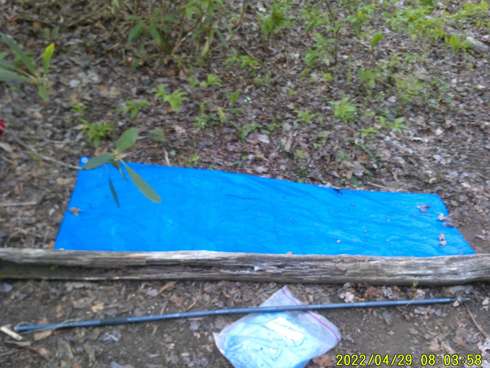
I made the stream on the map that was a tenth of a mile from Locust Grove Gap but it was dry. I continued on to Locust Grove Gap and arrived there close to the sun going down. The gap was pretty crowded with tents. There was a steep trail down to what I believe was the same dry spring I crossed but here the water flowed. I got my water for the evening and then layed out my bedroll on a hill with a log on the downside to keep me from rolling off my mat. I made my dinner and then I hid my food bag in the dark.
It was supposed to get cold but I was able to be all warm and snuggly.
AT 147.4 - 2046 to go
FRIDAY 4/29 Stecoah Gap
I was up at dawn because all the other hikers were breaking camp and being none too quiet about it. I broke camp myself and started hiking without breakfast.
Soon I started stripping down. Made Simp Gap, not sure what hill I went over to get to Simp Gap. The Mayapples were starting to come up.
I climbed another hill and then a gap before climbing Mt. Possible. After Mt. Possible there was another gap then a small hill before it started to descend down towards Stecoah Gap. The Cancer Roots were starting to become promident.
Found a cave at one point but it wasn’t a deep one.
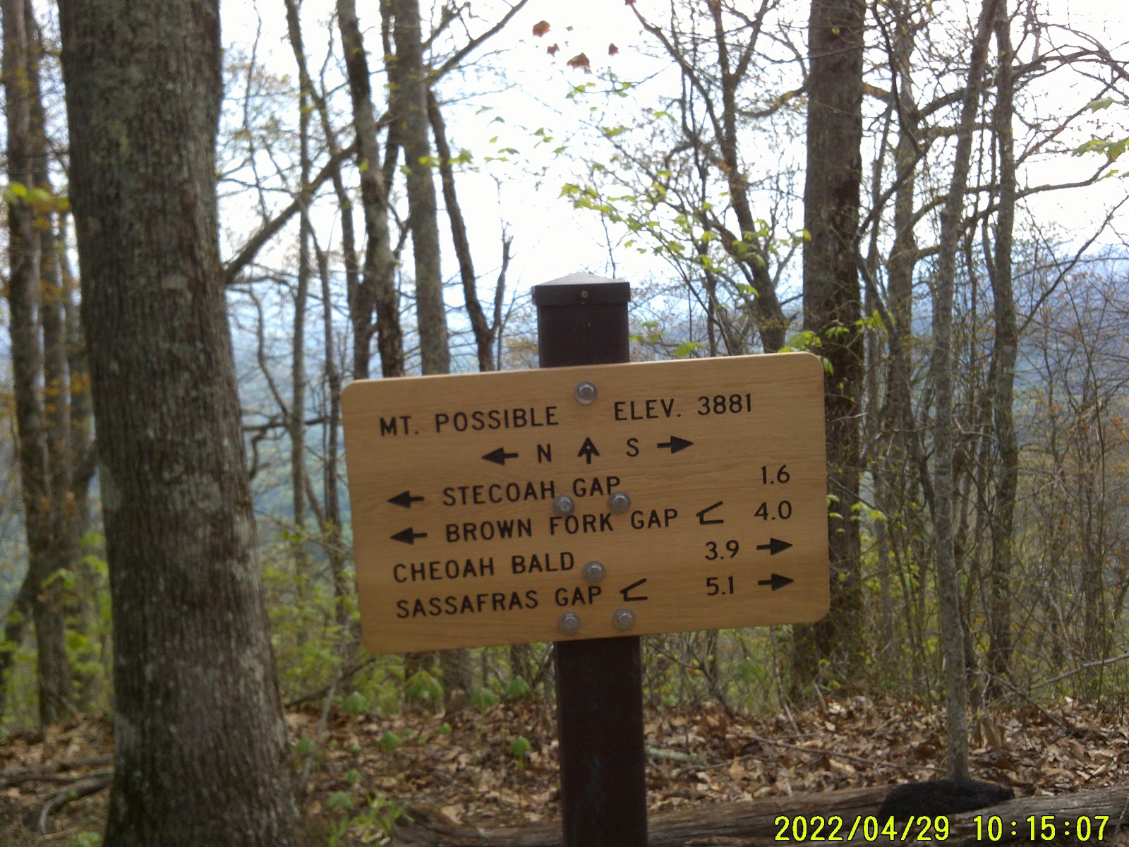
I have been hearing the highway since cresting Mt. Possible and now I could catch glimpses of it. My steps started to quicken.
Soon I got to a switchback that allowed me to look straight down at the trailhead. I was elated. I hurried on.
I had to go one more switchback and then it was a straight shot into the trailhead. I arrived at the trailhead with a welcome sight. Trash receptacles; only a thru hiker gets excited by trash receptacles. I unloaded my trash.
There are a couple of picnic tables there. The trail angels had been by. Two bags of apples, one was Granny Smith and the other one was Fuji, and a baker’s dozen of assorted donuts from the Ingles in town.
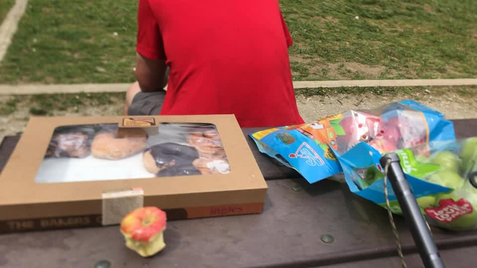
That was one of the best fuji apples ever! That fritter for dessert was scrumptious too.
Now to find a hostel.
I called the Stecoah Wolf Creek Hostel but I got no answer.
A trail angel pulled up and left a 12 pack of ramen noodles. She was very gracious in describing all of the vegetation we had been looking at around there and on the trail.
While I was waiting a man drove up and asked if we had seen (a woman) on the trail. Her name was Terri. He said he was a hostel owner. I asked if he had any vacancies. He said “yes”. The woman in question was hiking into this area and he was going to stop back by again later. He was heading to Robbinsville for a little business. He dropped me off at Ingles to resupply. We met up and he took me to the hostel.
The hostel is located in Stecoah at Wolf Creek.
We talked and I told him about my dealings with Ironhorse Motorcycle Lodge. He pointed out the spot where the old Stecoah Cafe used to be. It caught fire last October and burnt. The owners didn't have insurance so they couldn’t rebuild.
This hostel is nice. Two single bedrooms and two double bedrooms, shower, washer and dryer, kitchen privileges. With computer access. I may be here an extra day or two.
AT 150.6 - 2042 to go


No comments:
Post a Comment