April 4th to the 10th
Because of the weather, unpredictable rain storms and snow, I ended up staying at the Hostel for a week. Of course, another reason was that this hostel is way too comfy. I ended up spending two nights on the trudgen bed, two nights in the VW bus, two nighst in the big house, then a hiker came in and rented the cottage room with the four beds but only one of his buddies stayed. He sub rented the other two beds so I was back again on the trudgen bed.
The snow was just a dusting but later I heard from other hikers that in the Carolina’s it had gotten deep.
My time at the Hostel was spent getting an Osprey 50 L bag to replace that Mountain Top POS. Shaking the bag down until it weighed in at 25 lbs. A couple of trips to the Hiawassee library, a trip to Clayton and the Walmart there and evenings of conversing with the various hikers who passed through the Hostel. On the last night some trail angels came to the hostel after being at Unicoi Gap and performing trail magic. They still had some hamburgers left over so they made us all hamburgers.
But by the 10th it was time to leave; back to the trail or back home. I chose the trail.
That morning I settled up with Gordon and he gave me a ride to Dick’s Creek. After dropping me off he picked up some others and headed back Hiawassee way.
Dick’s Creek
My itinerary for today was to reach Plum Orchard Shelter which was only 4 ½ miles away. The pack felt great and I was making good time. About Cowart Gap I met a quad of ladies heading southbound from Blueridge Gap.They were “flat packing”; this is a term where the hiker has only the bare minimum in a small pack. I met them yesterday at the Hostel and they were awaiting a shuttle into Hiawassee. We exchanged pleasantries and I continued on. Soon I crested Buzzard Bald and descended into Bulls Gap. The vista overall was beautiful and here and there green was starting to show. Then I made Plum Orchard Gap.
Some politician made the fools decision to put all the shelters in Georgia at least a quarter mile off the trail down in a hole. Plumb Orchard was no exception. Down the trail following the blue blazes I headed. I came to a creek with a PVC pipe and I knew that was the water source for the shelter. I met another hiker coming to get water and asked him how far away the shelter was. He hooked his thumb behind him and replied, “Right there.”
And it was. Only a small climb up to the shelter.
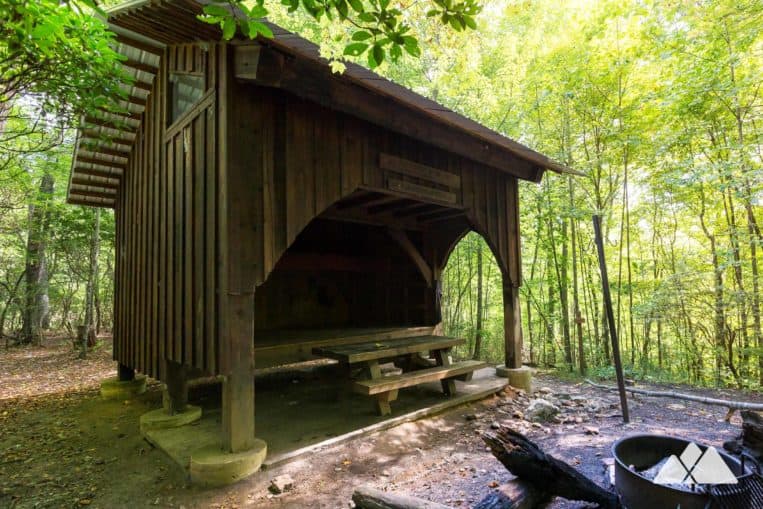
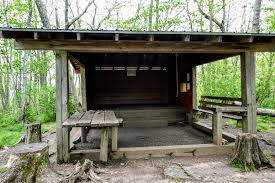
This shelter had a three tier platform. The main deck could hold about six, then the second tier could sleep about four crossways. Then the third tier was in the overhang and could sleep about four. I threw my stuff up on the second tier and made my bed. For supper I ate a dehydrated pack of Chicken Gumbo. It wasn’t bad but it wasn’t worth the money I spent on it.
One of the other hikers there turned in early and started to snore.
And didn’t stop.
AT 74 - 2119 to go.
MONDAY April 11
I awoke right at dawn when “Snorey the Bear” finally stopped snoring. His stopping woke us all up.
Snorey stayed in his bag the whole morning. I had noticed him last evening and he was distant. A couple came to the shelter last night that had met him before but he barely greeted them in monotone. I believe he was screwing himself up to leave the trail. I’m not clear why he is making it so hard on himself. I, myself, will leave the trail if I get to the point I don’t want to be on it. It’s not like my arm is being twisted. This is something I want to do and I’ll do it until I’m either done or… Well, either way when I leave the trail I’ll be done.
A lot of folks who get on the trail are like Emma Gatewood who started it as a lark. Them and her realize quickly it’s not. But Emma had the determination to keep on going. So many of the others don’t.
A lot leave the trail at Woody Gap at Suches A lot more hang in there until Dick’s Creek. And most will get off because they think that there is still 2000 miles of the same roller coaster terrain they had just experienced. If there was then I would had headed home after reaching Dick’s Creek.
I’m not going to blow smoke up my reader’s heinie and tell them that I’ve haven’t been surprised by what I’ve experienced on the trail; I’ve been surprised on a daily basis. If it wasn’t for that, I would be bored and gone.
I got started at 9 am. As I crossed the creek down from the shelter I started to following the trail, only to immediately start climbing a steep incline that I didn’t remember from the night before. I then realized that the trail was circularing back around to the shelter. I turned around and headed back. I met others coming my way and I expressed doubt to them that this was the right trail. They assured me it was, passed me, and in a few moments returned; admitting that they were wrong. We went back to the creek, since we all agreed that we crossed it yesterday when we came in, realized there was a trail to the immediate right as one crosses the creek with the blue blaze on a tree… covered by a bush.
We were able to climb out of the vale that the Shelter rested in and then As Knob.
First thing in the morning and I’m met with a 400 ft ascend. But I made it, eventually, slowly. But once the knob was summited I was rewarded with the descent to Blue Ridge Gap.
At the Gap was a fire service road and a large log that had it’s top cut to flatten and made a bench out of. I took a sit spell and met Poncho. I call him that because he was wearing a macrame poncho. We talked for a bit then I started climbing up the trail, out of the Gap and towards the state line. It was an 800 ft climb in three miles. Soon, on a narrow ledge I came to the state line.
Finally!

I did a photo opp here and soon a trio of hikers came up for their own photo opp. One of them pulled out a stuffed toy guinea pig and had his picture taken. Of course I had to inquire. The man’s uncle traveled extensively with a pet guinea pig until the pet died. Then he replaced it with the stuffed one. Now the uncle is too old to travel so his nephew has embraced the tradition and carries the toy with himself and gets pictures to send back to his uncle. Bless him.
Heading northward again I came off that ledge onto a wider area with water. I filled up and then after a short climb I was at Bly Gap.

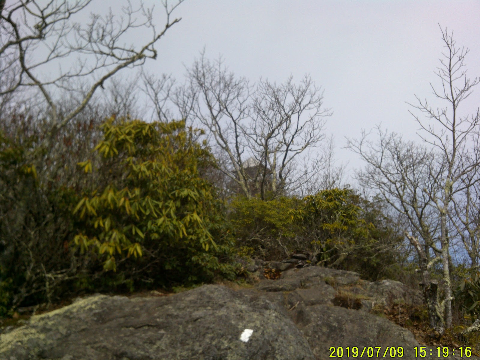
(the dates and times at the lower right of the pictures are wrong)
And there was the tree. More now than crossing the state line I felt I was in North Carolina and finally leaving the Georgia rollercoaster behind.
Then I got to looking around and up. I felt violated, I felt betrayed; there was another mountain right there that earned the title of Samuel L. Jackson’s catchphrase.
I remember seeing it in the guidebooks but one book would give it one name Sharp Top and another would give it the name of Courthouse Bald. I just knew I had to crest that mountain to get to Muskrat Creek Shelter
But I was looking at a 900 foot climb.
I made the climb and started down into what I thought was Sassafras Gap but soon I was climbing again. This was a double summit and maybe that was where the confusion with the names were; on peak was Sharps Top and the other was Courthouse Bald.
But it really didn’t take long for me to crest that second peak and start into Sassafras Gap.
At the Gap there was another there who had set up camp and had a fire going. I thought seriously about stopping there but I inquired about the water and the other hiker said I would have to go over the other rise to the north to find water. I continued on.
As soon as I crossed that rise I started heading down and coming upon other hikers who had set up camp. Soon I crossed Muskrat Creek and then immediately the access trail to the shelter. I could see the shelter from the trail.
I think I’m going to like North Carolina.
AT 81 - 2112 to go.
TUESDAY April 12
I slept well at the shelter and I was moving at my usual time of 9 am. The trail was a straight level dream here and soon I wized by White Oak Stamp and soon made Water Oak. At the intersection of Chunky Girl Trail I dropped my pack and stripped down some of my warm weather gear. Chunky Girl Trail is a shortcut to Franklin. It’s only 17 miles to US 64 down that trail. I continued on the AT to Deep Gap which is USFS 71 and took my lunch break. At Deep Gap, there is water, camping, and access to shuttles to go to Franklin, but only if one has cellular reception. I lunched at Deep Gap.
After Lunch I started to ascend again up a narrow trail. Even crossed a stream by a wooden bridge with a handrail. Then in a few hundred yards the trail widened as I entered into the Southern Nantahala Wilderness and soon I saw Standing Indian Shelter.
Even with a few hours of sunlight left I decided to stop for the night. When I arrived there was Lawnchair and Minus One already setting up. Minus One was of Laoian descent from Buffalo NY. He had thru hiked once before and was now coming back when he could and sectional hike. He was going as far as Damascus VA. I didn’t ask how he got his trail name Minus One. Lawnchair was retired from the Army, recently retired. He and Minus One had those small light chairs to set in. That’s how he got the moniker of Lawnchair.
I wasn’t feeling too well so I layed down in the shelter for a few minutes then I made my dinner. Another dehydrated meal I picked up in Hiawassee. It was throwing groceries down my throat but I started to feel better. Minus One built a fire and the three of us gathered around it and shot the bull. We were soon joined by Turtle. He had served as a Second Lt in the Army, just long enough to realize he wasn’t suited for Army life. He kept us quite amused with his misadventures.
Soon darkness set in and the four of us retired.
Side note: a couple showed up toward the end of the evening who had left Dick’s Creek that morning. Seventeen miles in a single day; it took me three.
AT 86 - 2107 to go
WEDNESDAY April 13
In the morning I got started at around 9 am. Lawnchair and Turtle had left already. Minus One was still packing up. The trail started the climb up Standing Indian Mountain with a bunch of switchbacks; that made the climb more enjoyable. About halfway up I was passed by Minus One (in reality, I was being passed by everyone). I realized that I had a signal on my phone and took a moment or two to inform folks I was still alive and not some love slave of a female Sasquatch. I also met that quad of slack packers again. Every day since Sunday I have met them. The leader explained they had a system where they were leaving a car at a trailhead and then hiking back to the car they left at the trailhead before. Why didn’t I think of something like that!
Soon I reached a spot where the trail was following on the top of a ridge that opened up on each side. The view was spectacular but my acrophobia was putting on an act. I was having to focus on the trail to get through this section.
When I reached the summit, there were camping sites. I stopped here and had lunch.
After lunch I continued on about ½ a mile then dropped my pack and started to strip; it had gotten warm. I donned my pack again and then it was like I was flying down the trail. I almost expected when I looked behind me to see a trail of fire from my passing but I wasn’t going quite fast enough.
At Beech Gap the trail started to climb again and crossed Kilby Creek. Then down to Coleman Gap. I had a leisurely climb up to Timber Ridge then down to the Carter Gap Shelter.

The grounds were pretty crowded with other campers. Lawnchair was there already with Turtle and they were taking up space on the platform of the shelter since it was going to rain during the night. They didn’t want to get their tents wet. Bless it.
Two others were also on the platform, they also didn’t want to get their tents wet. I cowboyed on the ground next to the table. Minus One set his tent up away from the crowd.
So ended the fourth day.
AT 94 - 2099 to go.
THURSDAY April 14
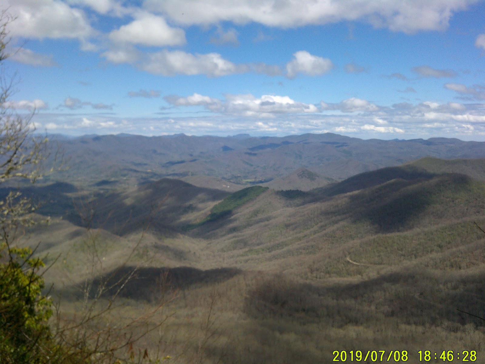
I had another start time of 9 am. About a mile and ¾ there was a lookout over the valley. The trail was covered well with a canopy of trees but I knew when I was getting close to it. The other hikers that were ahead of me would go the short side trail to the lookout and holler. When it was my turn and I looked out over that vista; I hollered.
(again the date and time are wrong)
I continued north again at a fast pace and made the Betty Creek Gap area. I rested a bit then I got to climb up to Mooney Gap. Mooney Gap was next to the USFS road that would go to the fire tower. I kept to the trail. After a tenth of a mile I came to a culvert and was able to get water. Here is where the fun began.
The trail got very narrow and steep here. About a ½ mile up I had to stop to rest. Soon I was passed by Lawnchair heading with that big 10 L pack of his to fill with water. He would fill that pack and bring it back to the camp and allow anyone that needed water to fill up. What wasn’t used he would pour out in the morning.
He told me that He and Minus One were about ½ miles up and camping. That’s where I was heading. I soon reached the spot. It was next to the USFS road and surrounded by Rhododendron, or as I call them “Rhino bush”.
I decided to try my hand at hammock camping. I hung my hammock and put a tarp on the ground. I rested for a few minutes in the hammock then made my dinner. Lawnchair had returned with the water. After we had all eaten we basically enjoyed the fire and shot some more bull. We kept hearing the sound of a two stroke engine trying to start and I mentioned it. Lawnchair, who was familiar with this sound told us it was a Grouse, a chicken size bird where the males beat their wings on the ground to attract a mate.

I could have sworn that was a two stroke engine.
Soon we were bed bound.
AT 99 - 2094 to go
FRIDAY 4/15 Good Friday
The night was cold again. The wind was wicked. The rhino bushes weren’t helping. After midnight I had to abandon the hammock and cowboy on the tarp with my pack at my back. That helped against the wind. Soon I was able to get some sleep. The wind stopped around dawn.
In the morning I used the calm to get a few more shuteye before rising and breaking camp. Lawnchair and Minus One were doing the same. I was the last to get going.
Didn’t take long to make Bearpen Gap and that is where the climb begun. It was steep, a few times I was using both hands and feet. At one point I was getting ready to go back to Bearpen Gap and use the road to go around but I saw the tower and it drew me on.
I made the summit. A crowd was there. They cheered my arrival. It was nothing special, they cheered everyone that made that climb.
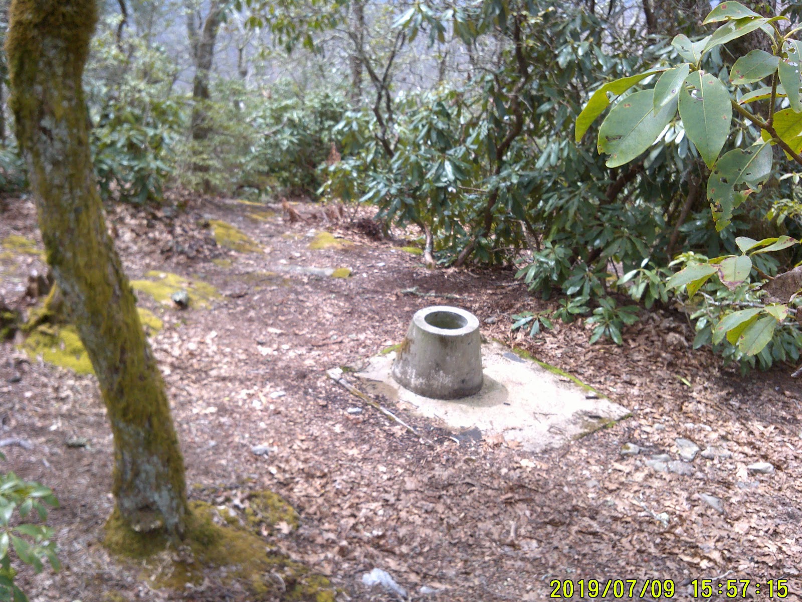
I partook of lunch from my supplies at the foot of the tower. Took a couple of selfies overlooking the view and then climbed up the tower to the first landing. That’s as far as my acrophobia would allow. While up there I spied what looked like the old well for the firetower. After I climbed down I went over to investigate and realized this was actually the old privy. The walls around it were gone but the concrete seat was still there.
I moved on.
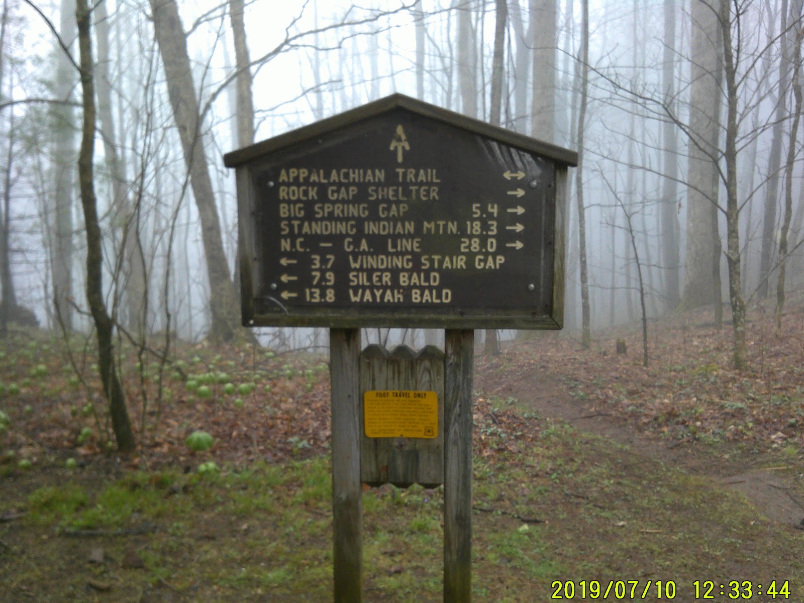
The trail on the north side followed the old road to the tower. The trail left the road at Big Spring Gap. I passed the old cut off trail for the old Big Spring Shelter but I didn’t stop to investigate. Just past the cut off for Long Branch Shelter was a stream that I got water from. From here the trail gently climbed to Glassmine Gap. From there it was downhill to Rock Gap Shelter.

Rock Gap Shelter wasn’t placed in the most optimal spot except the stream was right behind it. None of the camping sites were level so this was a spot more suitable to hammock. I knew rain was coming again so I got into the shelter and claimed a spot next to the wall. Lawnchair was there and had his tent set up on the hill above the shelter. Minus One went farther on down into the vale and found flat ground. He tends to like to set up away from the crowds.
I basically spent the evening listening to fellow hikers talk and BSing with Lawnchair. He did ask me how my feet were holding out and I told him “pretty good”. They had a soreness that was to be expected but they were doing fine. Lawnchair pointed out a bloodshot he saw on the outside left heel of my sock. I checked it out and found that a blister had busted on the heel. I had contributed the soreness in that area to a possible stone bruise. I got out the Neosporin, mole skin, and KT tape; I soon had it fixed right up.
On the platform slept five of us. It was a tad bit crowded.
(Note: a lot of the pictures of the various shelters I’m pulling off the web. The forward camera on my phone doesn’t work and the digital camera I’m using has a battery that needs recharging by evening. In the morning time I’m so busy getting ready that I don’t think to take a picture)
AT 105 - 2088 to go
Saturday April 16
This is it. This is the day I get to Winding Stairs Gap. This is the day I get to Franklin.
I was awakened around 4:30 am by a hiker who goes by the name Woodstock who tends to cowboy camp too. He was setting up his bedroll on the ground next to the platform where he would be protected by the roof overhang. No sooner that he finished then the rain came pouring down. Around 5:30 three of the other shelter hikers awoke and started to get ready. They were bad about stomping on the platform; why? I’m not sure. At 6:00 they left with their little headlamps illuminating the way.
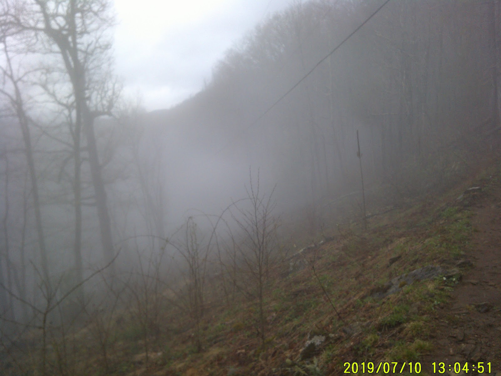
I snoozed until 8:00 and was ready to roll at 9:00. Lawnchair and Minus One had already left. They were to meet a shuttle at Winding Stairs Gap at noon. I walked the short distance to Rock Gap in a light fog, which was next to Standing Indian Rd and there were trash bins. Great! All this trash I’ve been carrying since Dick’s Creek was now going to take up temporary residency in those bins.
After disposing of my trash and biding it a fond farewell I resumed my northward foggy trek; which was an upward climb on a narrow trail. At Wallace Gap, which was the intersection of Standing Indian Campground Rd and Allison Creek Rd, the trail crossed the highway then started to climb more steeply towards Rocky Cove Knob.
By the time I crested the knob the fog has burned off.
Soon I was making my descent into Winding Stairs Gap. I kept hearing the occasional Grouse doing their mating call until I realized that that wasn’t them. It was the sound of Jake Breaks from a semi. That meant US 64 was near. My pace quicken.
As I stepped onto the pavement at the parking area I was sort of disappointed that no one was doing trail magic. On a concrete pad next to the parking lot someone had set a gallon jug of “town” water and a tangerine. I had trail magic after all. To me that tangerine tasted better than any hot-dog I could have gotten from the trail angels. I left the town water.
I arrived at 12:45. Lawnchair and Minus One had caught the shuttle and was already in town. I had no cellular signal so I was going to see if I could ride my thumb into town. But first a little set spell.
As I was resting I struck up a conversation with an elderly gentleman who was up there with a group who was doing trail cleanup. He told me of a shuttle service that came through this Gap and Rock Gap at regular intervals going to Franklin. That sounded great! But while talking to him Turtle came strolling up. He spent Friday night in Franklin and had a shuttle pick him up at Rock Gap then return him this morning. He knew that the regular municipal shuttle wasn’t running this weekend due to it being Easter.
Drat!
The cleanup crew returned from the woods and the leader was a trail ambassador. Of course they would get me to town.
I am looking forward to the next two days being zero days.
AT 110 - 2083 to go.


No comments:
Post a Comment